|
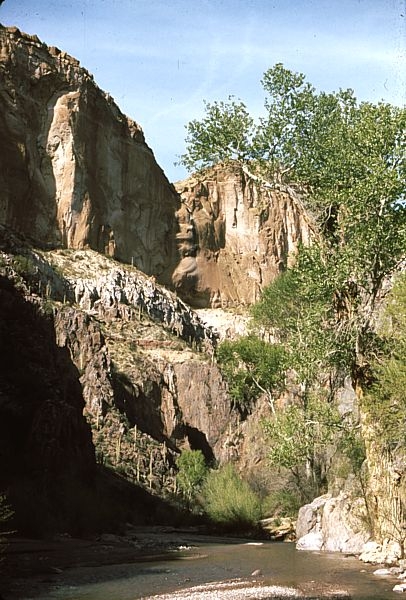
37 years, from March 1973 to May 2010, Aravaipa Canyon from about 0.3 miles
downstream of the Javelina Canyon confluence, looking upstream
north-northeast. See the map. The 1973
image was taken later in the day and so the east-facing slopes are
more deeply shaded.
A sapling Fremont cottonwood tree (Populus
fremontii) slightly left of bottom center, seems to have grown
to a sizeable tree. Look to the left of this and up the
rocky slope: I count eleven saguaros in 1973 and only four in 2010.
This is extremely remarkable since saguaros are very long-lived,
reproduction, therefore, very slow. The individuals that disappeared
may have been as much as 50-150 years old.
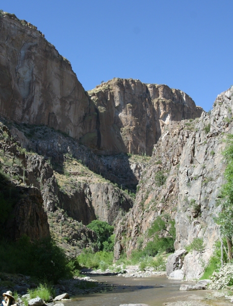
A group of what may be willow saplings (Salix
bonplandiana) slightly to right and in front have disappeared. The
large cottonwood trees on the right bank of the 1973 image are absent
in the 2010 image.
Although much of the floodplain is hidden in shadow in
the 1973 image, it does seem like two major differences are apparent.
First, the floodplain seems rockier and there seems to be more rubble
piled up on both banks in the 2010 image. Second, the 2010 image seems
to show more vegetation overall in the floodplain.
The first would have resulted from greater sediment
transport and deposition in Aravaipa Canyon. Possibly from more
frequent catastrophic floods? The greater vegetation may be simple
response to the fact that there is more available substrate in the
floodplain. |